IMB says vigilance still needed as Indian Ocean piracy High Risk Area reduced
 Shipping organisations have agreed to reduce the boundaries of the piracy High Risk Area (HRA) in the Indian Ocean, as incidents in the region, particularly in Somalia, continue to decrease.
The changes will come into effect from 1st September. They were approved by the Baltic and International Maritime Council (BIMCO), International Chamber of Shipping (ICS), The International Association of Dry Cargo Shipowners (INTERCARGO), The International Association of Independent Tanker Owners (INTERTANKO), and Oil Companies International Marine Forum (OCIMF), representing the global shipping and oil industries.
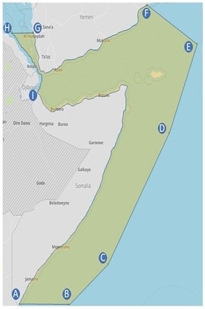
In broad terms, the amendments will reduce the HRA boundaries to the Yemeni and Somali Territorial Seas and Exclusive Economic Zones in its eastern and southern reaches.
The HRA was created at the height of the Somali piracy threat in 2010 to show shipowners, operators, and seafarers where pirates operated and where extra vigilance was required to avoid attacks.

Subsequent updates to the HRA have reflected the changing nature of threats in the region have emerged as well as the existence of more severe security threats, such as piracy off West Africa, necessitating a change in how industry assesses such dangers to shipping.
Guy Platten, ICS Secretary General said, “The security landscape is constantly evolving, and as new security threats have emerged or intensified outside the Indian Ocean it has become clear the HRA is outdated and misleading.”
David Loosley, BIMCO Secretary General and CEO said, “As demonstrated with the recent security incidents in the waters around the Arabian Peninsula, we need a more granular approach to the concepts of threat and risk. The next logical step is to develop a global, threat-based concept which captures how ships of various type, size, nationality, ownership etc. face different risk levels.”
Whilst the trimming of the boundaries may signal a step in the right direction where Somali piracy is concerned, ICC International Maritime Bureau (IMB) is urging caution. “Although the threat of Somali piracy has reduced substantially, we continue to encourage all vessels transiting these waters to remain vigilant and be aware of the evolving maritime security landscape.” IMB says.
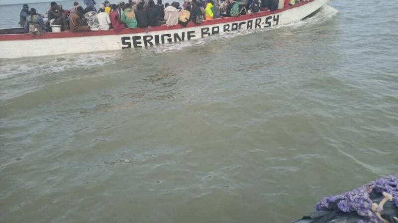
Generally Somali pirates tend to be well armed with automatic weapons, RPGs and have been known to sometimes use skiffs launched from mother vessels, which may be hijacked fishing vessels or dhows.
The new coordinates of the HRA are: From position A (Latitude of 01 30’S on the Somali coast), a line to
Position B (01° 30’ S – 046° 00’ E), a line to
Position C (01° 00’ N – 049° 30’ E), a line to
Position D (09° 00’ N – 055° 00’ E), a line to
Position E (14° 20’ N – 057° 30’ E), a line to
Position F (the Yemen coast at longitude 053° 00’ E), then
Follow the Yemeni coast westwards and northwards, to
Position G (the Yemeni Red Sea coast at latitude 15° 00’ N), then a line to
Position H (the Eritrea territorial sea border at latitude 15° 00’ N), then
Follow southwards first Eritrea’s and then Djibouti’s territorial sea borders, to
Position I (the coastal border point between Djibouti and Somalia), then
Follow the Somali coast eastwards and then southwards, to Position A.